This week on Jeju: A to Z, Todd Thacker takes a brief look Saryeoni Forest and its popular walking trail, located in a UNESCO-designated Biosphere Reserve east of Jeju City.
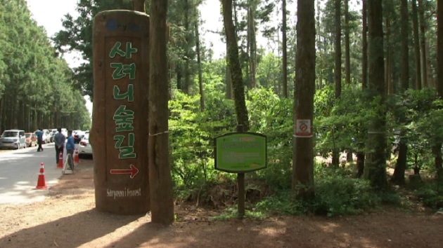
This is the Saryeoni Forest Trail, a popular course that meanders north-south between Jeju City and Seogwipo on the eastern side of Hallasan Mountain.
[Slug CG]
Saryeoni Forest Trail suitable for all ages, fitness levels
The full 15-kilometer course runs through Jeju’s UNESCO-designated Biosphere Reserve. About 500 to 600 meters above sea level, it is an evenly graded path that is walkable by people of all ages and fitness levels.
Known for its annual “eco-healing” walks and associated programs, hikers can spot a wide variety of trees, including dogwood, maple, and hornbeam. The forest’s cedar and cypress trees are home to many bird species.
[Slug CG]
Variety of trees, geological formations
On the southern end of the trail is Saryeoni Oreum, the tallest volcanic cone in the area. It is noteworthy for its horse-shoe shape, steep slopes and a small volcanic feature on its western side.
If you’d like to take a stroll along the path, there are some recent developments to keep in mind.
[Slug CG]
Improved facilities, parking relocated off-site
Given the popularity of this forest trail, the local government has improved public facilities including washrooms and benches. However, space for individual cars is quite limited. To solve this problem, Jeju City has relocated the parking areas and increased city bus service and shuttle buses.
Note that Mulchat Oreum, which is also also along the trail, is closed to hikers for most of the year so that the volcanic cone’s natural ecology can recover. However, this year it will open to small groups of hikers, with no reservations required, from June 16th to 24th.
[Slug CG]
Todd Thacker
Saryeoni’s peaceful walking path and distinctive volcanic cone provide both locals and visitors alike with the chance to enjoy this area’s own small piece of paradise.
Todd Thacker KCTV